Heard people say “West of Trail” and wondered what it really means for your Sarasota home search? If you are relocating or downsizing and want in‑town living near the bay and downtown, the phrase comes up fast and often. The catch is that it’s local shorthand, not a fixed boundary, so it can confuse more than help. This guide explains the term, shows you how to map it, clarifies how Arlington Park fits into the picture, and outlines the lifestyle, tradeoffs, and pricing drivers you should expect. Let’s dive in.
What “West of Trail” actually means
Locals use “the Trail” to mean the Tamiami Trail, also labeled U.S. Highway 41 or US‑41. When someone says “west of Trail,” they mean the mainland neighborhoods on the bay side of US‑41. It is an informal descriptor, not an official planning line.
For buyers, the phrase usually implies three things: closer to Sarasota Bay and downtown, more compact and older housing stock, and greater walkability than many areas farther east of US‑41. It is a helpful search shortcut, but you should always verify the exact location on current City and County maps.
Our working definition for this guide
To keep things clear, here is the inclusion rule used in this article:
- “West of Trail” refers to mainland neighborhoods on the west side of US‑41, from the Trail to the bayfront.
- Barrier islands such as Lido Key, Siesta Key, Longboat Key, and Bird Key are excluded because locals typically refer to them by their island names.
- Because the term is informal, confirm any property’s location with current City of Sarasota neighborhood maps, Sarasota County GIS and parcel records, and FEMA flood zone data before you act.
How to map it in minutes
Follow this quick workflow to validate whether a specific address is west of the Trail and to understand its block context:
- Identify US‑41 on your map. That is “the Trail.”
- Open City of Sarasota neighborhood maps and Sarasota County GIS to overlay official neighborhood boundaries.
- Apply the inclusion rule above and note which side of US‑41 the property sits on.
- Check FEMA Flood Map Service Center for the parcel’s flood zone and base flood elevation.
- Pull 6 to 12 closed sales from the local MLS within a 2 to 3 block radius to understand pricing, lot size, year built, and renovation level.
Arlington Park: where it fits
Arlington Park is a sought‑after in‑town neighborhood that sits on the inland side of US‑41 under the definition used here. That means most Arlington Park addresses are not technically “west of Trail,” even though they share many of the same practical benefits. You will still find short drives to the bayfront and downtown, access to parks and services, and a convenient location near major medical facilities.
If you are comparing Arlington Park with west‑of‑Trail blocks, evaluate them side by side at the map level. Focus on walkability within a 5 to 10 minute radius, parcel size and parking, and the home’s year built and renovation status. Then layer in flood zone and elevation, since those factors can change insurance costs and total monthly ownership costs.
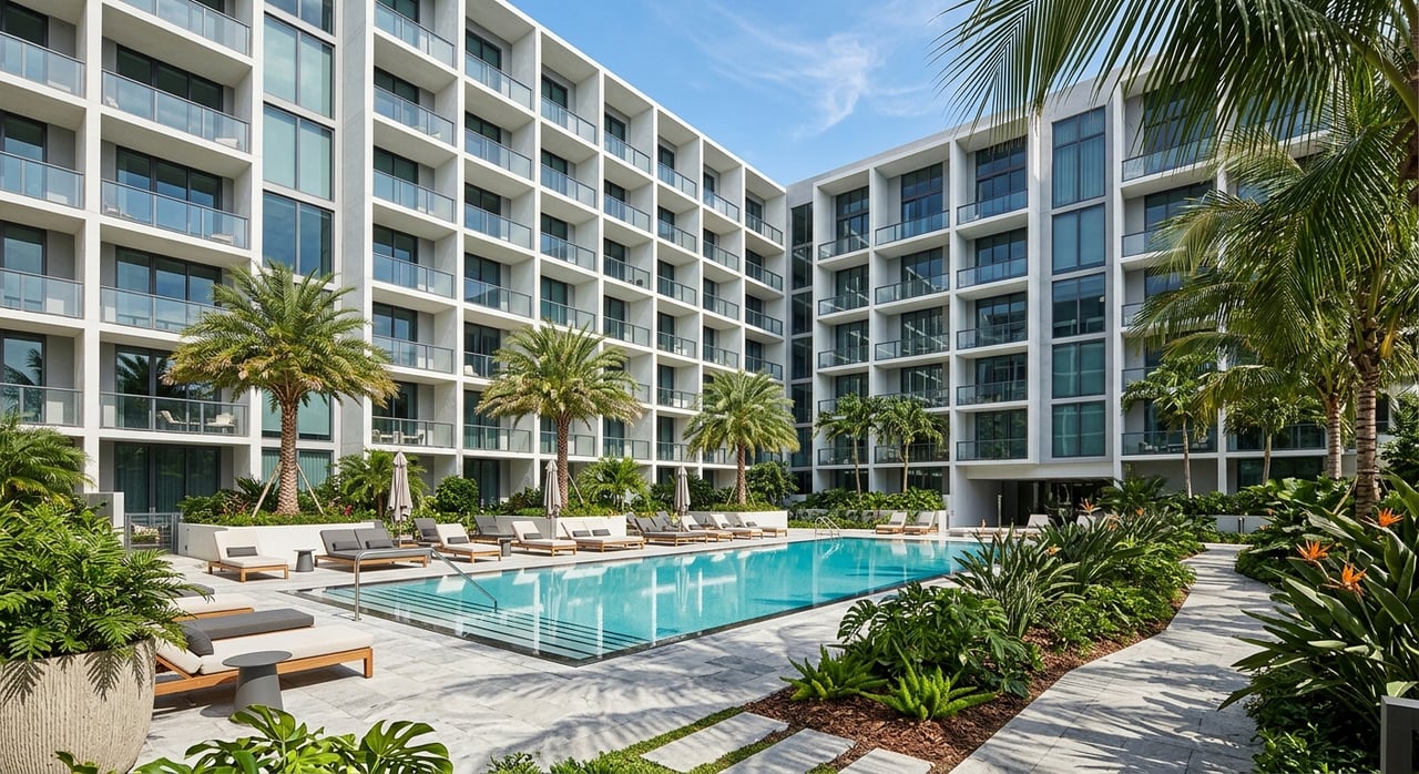
Lifestyle you get west of the Trail
Buyers choose west‑of‑Trail neighborhoods for a specific lifestyle. Here is what you typically gain:
- Proximity to downtown cultural venues, marinas, and bayfront parks, including performing arts like the Van Wezel Performing Arts Hall.
- Higher walkability to restaurants, shops, and everyday services.
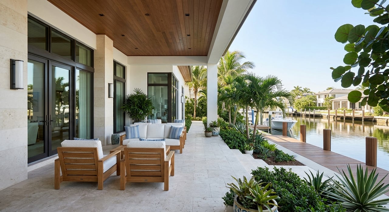
- Bay access and views on select blocks, including docks and boating options where permitted.
- Compact parcels and mature tree canopy with an older housing mix that offers character and scale.
- Street patterns that may include narrower roads and more on‑street parking compared with newer communities farther east.
- Quick access to major healthcare and specialty clinics, a key priority for many empty‑nesters.
A practical note for relocators: if step‑free living is a priority, search by building type, such as single‑story homes or condos with elevators, rather than relying on the “west of Trail” label alone.
Why prices vary block to block
You will see sharp price differences within just a few streets. The biggest drivers include:
- Waterfront and water view. Direct bay frontage, private docks, or panoramic views command the largest premiums.
- Lot size and orientation. Wider or deeper parcels and corner lots often sell for more.
- Elevation and flood zone. Lower elevations or higher‑risk flood zones can mean higher insurance premiums and different financing considerations.
- Year built and renovations. Move‑in condition and updated systems can add significant value.
- Zoning and redevelopment potential. Parcels with multi‑unit or infill potential are often priced for their future use.
- Views, privacy, and canopy. Mature trees and protected outlooks add appeal.
- Noise and traffic exposure. Proximity to US‑41 or busy commercial corridors may reduce desirability versus calmer adjacent blocks.
- HOA or condo dynamics. Monthly fees, amenities, and maintenance tradeoffs influence buyer demand differently than fee‑simple homes.
A useful rule of thumb: for otherwise similar homes, being one block closer to the water or one block farther from a major road can change price by tens of percent. Always confirm with several nearby closed sales rather than a single example.
Micro‑neighborhoods commonly grouped as west of Trail
Because usage is informal, you will hear different lists. Depending on the speaker and context, people often include:
- Downtown and bayfront‑adjacent areas near cultural venues and parks.
- Golden Gate Point and small bayfront peninsulas, often prized for panoramic views.
- Rosemary District, Burns Court, and nearby historic blocks, which offer a compact, walkable mix of cottages and small condos.
- Smaller enclaves immediately west of US‑41 with a blend of single‑family homes and low‑rise condos.
Treat each of these as a map exercise. Verify boundaries on City and County maps and assess flood zones, parcel sizes, and recent MLS sales for the specific blocks you are considering.
Buyer checklist for Arlington Park and west‑of‑Trail
Use this quick checklist to keep your search focused and factual:
- Define your inclusion rule. For this guide, west of Trail equals the mainland west of US‑41 to the bayfront, excluding barrier islands.
- Map your target blocks with City and County GIS and note FEMA flood zones and elevation.
- Prioritize must‑haves: single‑story options, 5 to 10 minute walk radius, parking, and proximity to healthcare and shops.
- Pull 6 to 12 recent closed comps within a 2 to 3 block radius. Compare lot size, year built, renovation level, and flood zone.
- Check permitted improvement history and confirm no open permits with the City or County.
- Ask about nearby infill activity or planned development that might change privacy, canopy, or views.
- Get homeowners and flood insurance quotes early, since premiums can affect your monthly budget.
Seller checklist to explain value clearly
If you are selling a home near or within west‑of‑Trail areas, help buyers understand your block’s strengths:
- Provide recent local comps within 2 to 3 blocks and explain differences like view, lot width, elevation, and upgrades.
- Document permits and system upgrades to show the home’s condition.
- Share an elevation certificate or flood‑zone documentation if available.
- Highlight walkability, nearby medical services, and access to cultural amenities.
Common search pitfalls to avoid
- Relying on the label without a map. Always locate the property against US‑41 and verify its flood zone and elevation.
- Assuming barrier islands count. Islands are marketed under their own names rather than as “west of Trail.”
- Generalizing from one sale. Use several closed sales within a tight radius for pricing guidance.
- Ignoring parking and street patterns. Narrower streets and on‑street parking are common in older west‑of‑Trail blocks.
- Skipping insurance quotes. Flood and wind coverage can shift the total cost meaningfully.
Ready to explore Sarasota’s in‑town living?
If you want the clarity, pricing accuracy, and white‑glove support that make high‑stakes decisions feel easy, our family‑led team is ready to help. We will map your options precisely, line up block‑level comps, and guide you to the right fit near Arlington Park or across Sarasota’s west‑of‑Trail neighborhoods. Start the conversation with the Fox Leiter Team.
FAQs
What does “West of Trail” mean in Sarasota real estate?
- It refers to mainland neighborhoods on the west side of US‑41, generally closer to Sarasota Bay and downtown, using an informal local shorthand rather than an official boundary.
Is Arlington Park considered West of Trail?
- Under the definition used here, Arlington Park sits on the inland side of US‑41, so it is not technically “west of Trail,” though it offers similar in‑town convenience.
Are barrier islands included in West of Trail searches?
- Typically no; locals refer to islands like Lido, Siesta, Bird Key, and Longboat by their island names rather than grouping them under “west of Trail.”
How do flood zones affect West of Trail buyers?
- Flood zone and elevation can change insurance costs and financing options, so you should check FEMA data for each parcel and get quotes early in your search.
Why do prices vary so much within a few blocks?
- Differences in water frontage or view, lot size and orientation, elevation, renovation level, zoning potential, privacy, canopy, and traffic exposure can shift value significantly.
What is the best way to compare two West of Trail homes?
- Pull 6 to 12 closed sales within a 2 to 3 block radius for each home and compare lot size, year built, renovation level, flood zone, and proximity to busy roads or the bay.